Whitby History Walks

EPISODE I ~ Grinkle Tramway
EPISODE II ~ Loftus to Whitby Railway
EPISODE III ~ The Castles of Mulgrave
EPISODE I ~ Grinkle Mine to Port Mulgrave Tramway (5.8 miles)
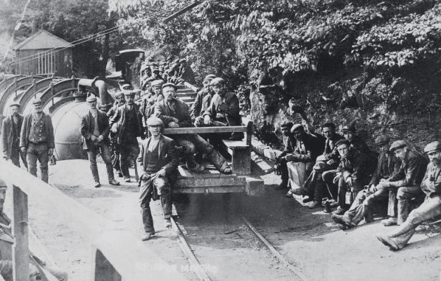
Grinkle Mine was an ironstone mine working the main Cleveland Seam. Initially, the ironstone was mined specifically for the furnaces at the Palmer Shipbuilders in Jarrow but later became independent of Palmers.
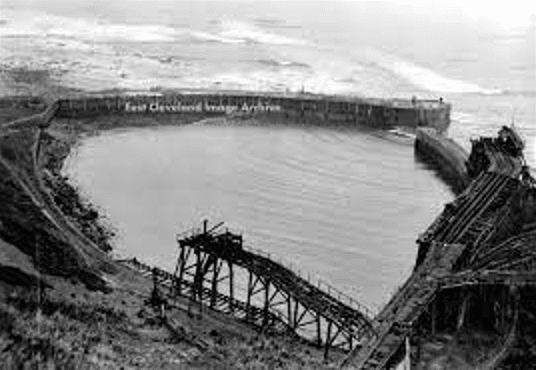
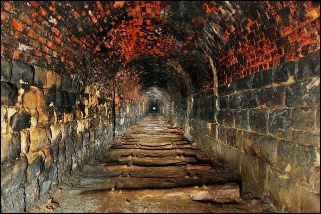
To enable the output from the site to be exported, a three-mile narrow-gauge tramway was constructed … it ran across three viaducts and through two tunnels to a harbour at Port Mulgrave, where ships would transport the ore to Tyneside.
During WWI, the threat of wartime action on the harbour led to a connection being built from Grinkle direct to the main Whitby to Loftus railway line just to the north of the mine head. Whilst this allowed for the closure of the port to shipping in 1917 (it was blown up!), the tramway stayed open to transport miners from Port Mulgrave to the mine site.
It first ceased production in 1921, with sporadic years of mining taking place. However, the mine was closed for good in 1930 and part of the site is now underneath the surface working of the more modern Boulby Potash Mine complex, though some buildings remain at ground level.

Our Walk … traces the course of the old tramway (over the tunnel sections). It starts in earnest deep inside Easington Woods and in the shadow of the giant Boulby Mine. Onto Ridge Lane, before dropping down into Roxby Woods and Dalehouse. Skirting Seaton Hall, the route heads for the clifftops before steeply descending down onto the beach at Port Mulgrave.


Boulby Potash Mine > Ridge Lane tramway tunnel > Grinkle engine house > Engine house archaeology


Engine house tramway wall > Grinkle Mines > Roxby Woods > Dalehouse approach

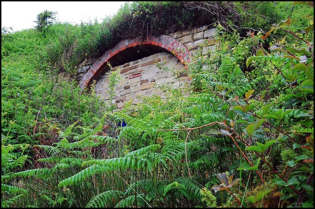


Dalehouse > Port Mulgrave Tramway Tunnel > Harbour > Beach
EPISODE II ~ Loftus to Whitby Railway – our walk covers Hinderwell to Whitby (13.1 miles)
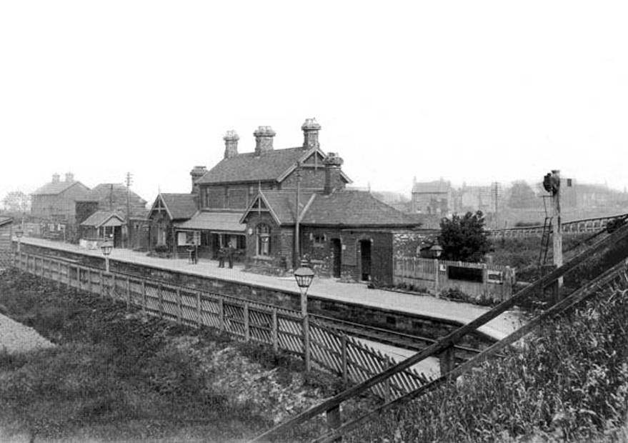
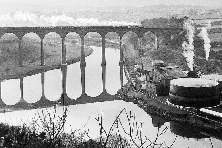
Hinderwell Station (“for Runswick Bay”) > Larpool Bridge and Whitby Gas Works (fueled by whale oil!)
Whitby had already been connected to the national rail system via The Whitby and Pickering Railway since the 1830s.
The Whitby, Redcar & Middlesborough Union Railway was built between 1871 and 1886 and ran from Loftus to the River Esk at Whitby … connecting Middlesborough to Whitby along the coast.
For much of its journey, the line hugged the cliffs but had a troubled build, due to the proximity to the sea and the poor quality of the construction on many of its original bridges and viaducts. The line was closed to passengers in 1958, but the northern section to Boulby Potash Mine was re-opened in the 1970s. It was a single track throughout, however, all stations (bar Sandsend) had passing loops.
The disused line was kept in situ from Bog Hall Junction to Hawsker Station until 1973 due to failed hopes of sinking a new potash mine at Stainsacre.
Dwindling passengers ensued, after the war years, the route was only popular during summer weekends. The line’s costs began to exceed revenue, this particularly applied to the viaducts and tunnels from Kettleness to Sandsend. In 1960 work began to dismantle the line, viaducts were sold for scrap metal and concrete was used in the construction of sea defences.
Our Walk … although there is very little evidence of the line’s existence here, HINDERWELL makes for a fitting beginning to this story and warrants a visit. Our walk starts in earnest at the site of the old Hinderwell Railway Station. The twin chimneys of Railway Cottages in the background are the only indicator of its history. After a short stroll across fields and along lanes, we reach the next leg at Ellerby Lane.


Hinderwell Station soon after demolition > Present day > Railway cottages > Station approach
>>>>
From RUNSWICK BAY we are able to faithfully follow the original railway line, along a relatively new ‘permissive path’ to KETTLENESS … a superb and easy amble.
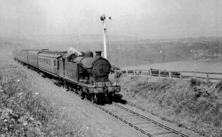
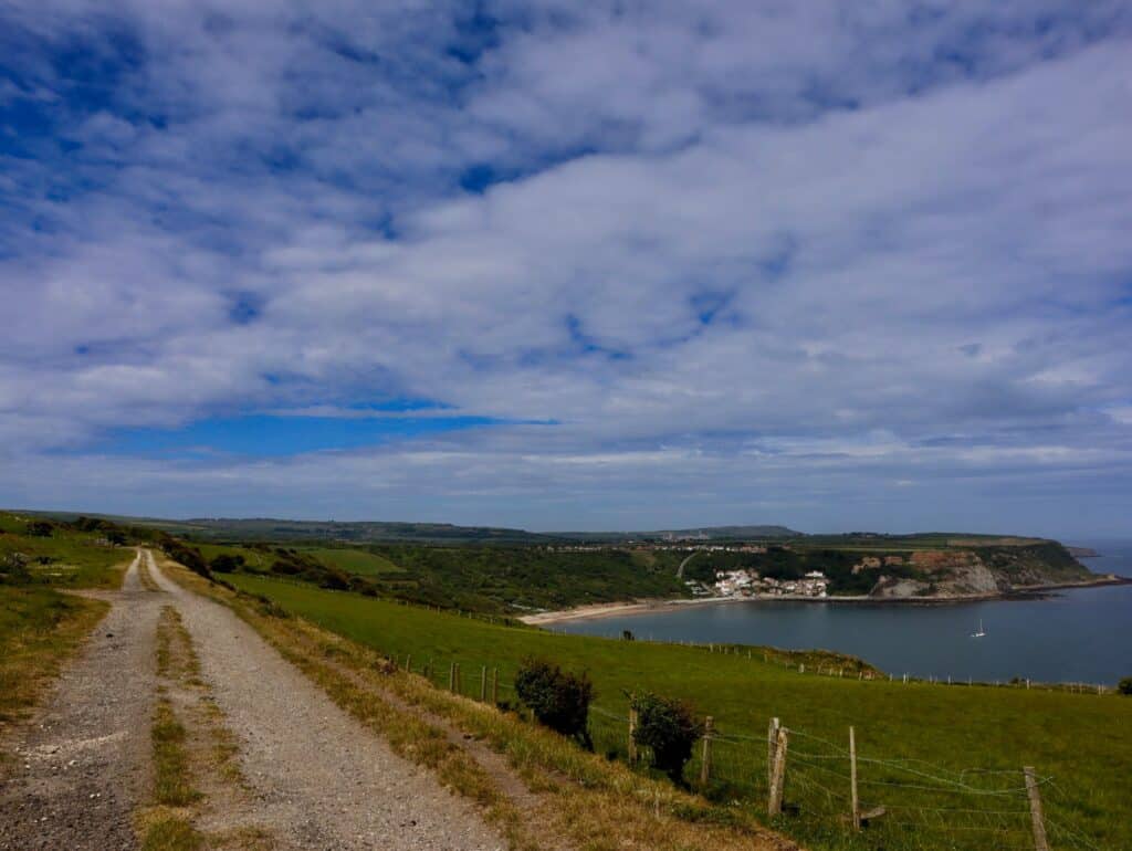
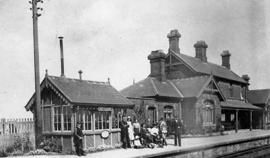
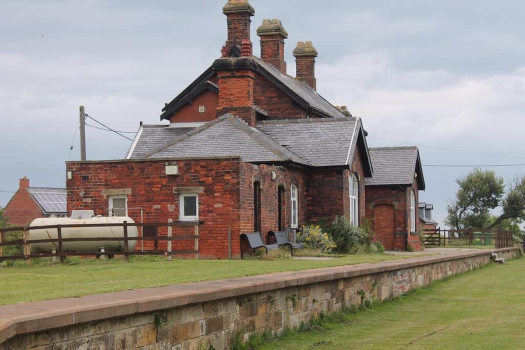
Runswick Bay then > Runswick Bay now > Kettleness Station then > Kettleness Station now
>>>>
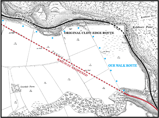
The next walking section is a real clifftop treat, covering the area between Kettleness and the old alum works at Sandsend. The railway was originally intended to also run along the cliffs, but financial problems and constant battles with the weather during construction resulted in abandonment … TWO TUNNELS were built instead.
>>>>
A short diversion off the Cleveland Way enables us a view of the first tunnel, the secluded northern portal of KETTLENESS. It was the shorter of the two, at 308 yards, and curved inside … meaning that entering trains were soon plunged into darkness!
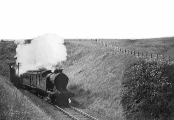
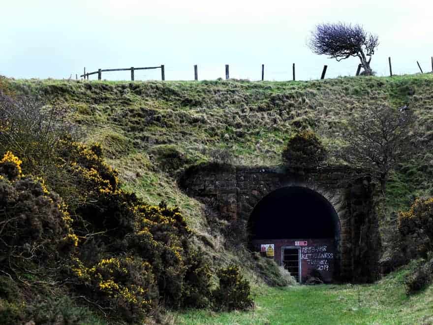
Kettleness Tunnel North then > Kettleness Tunnel North now
>>>>
There is a little known gap between the two tunnels. Now overgrown with trees and shrub, and out of view from our clifftop vantage point, the brief snapshot of daylight and the sea must have been a real thrill for passengers(?). The SANDSEND northern portal collapsed in 2008 after years of pressure from the cliffs above.
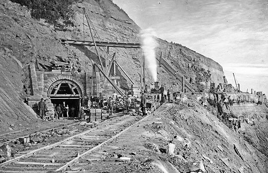
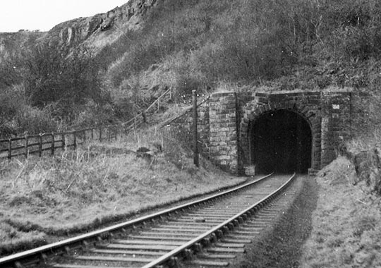
Kettleness Tunnel South construction > Sandsend Tunnel North
>>>>
The second tunnel … SANDSEND .. is the longer of the two at 1,652 yards. There were originally two air shafts, but three more were added later, following complaints by rail crew of soot and steam! They were all capped in 1958 and now sit hidden in the fields that we pass by. In addition, there were two service galleries (addits) leading off horizontally to the cliff face. They were used to dump the spoil while carving out the tunnel. The southern portal is still clearly in view and on our route (at the foot of the steep steps). It is now considerably flooded and the entrance is bricked-up.
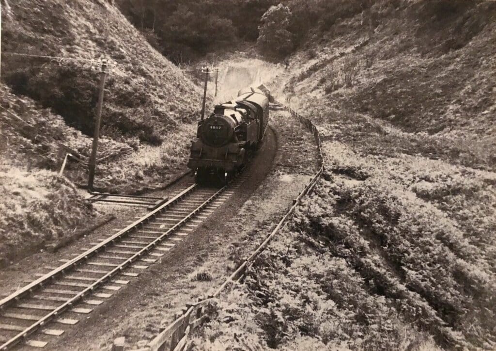
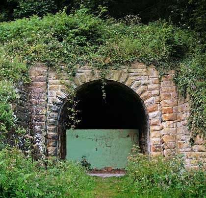
Sandsend Tunnel South then > Sandsend Tunnel South now
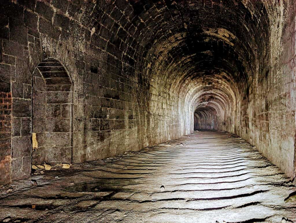
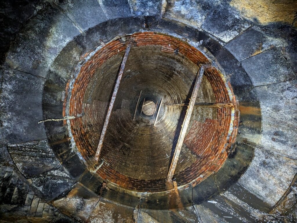
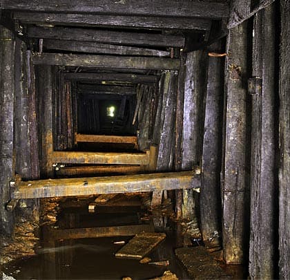
Inside the tunnels > Ventilation Shaft > Addit
>>>>
Sandsend Alum Works operated between 1605 and 1871. The railway slices right through it, operating between 1886 and 1958 … therefore, it was built AFTER the works were closed.
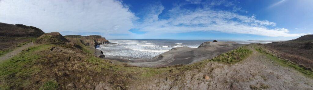
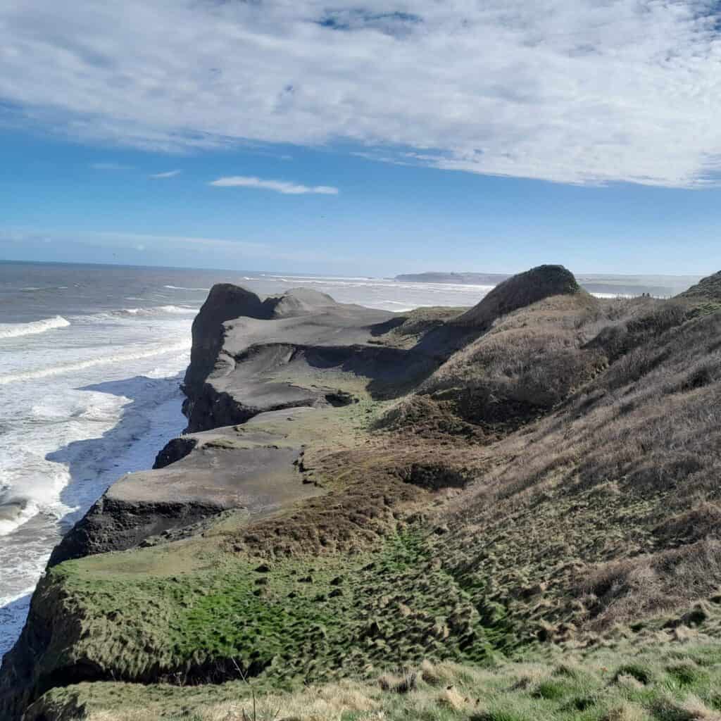
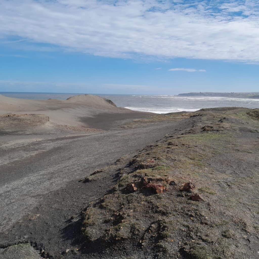
Alum was a chemical mainly used in the textile industry to fix dyes. Vast quantities of overlying boulder clay and sandstone had to be removed before the alum shale could be reached. The whole process was labour-intensive, expensive and highly polluting. Extraction left great scars on the area … resulting in the surreal, almost lunar-like landscape you see to-day.
>>>>
SANDSEND, in context of the railway, was dominated by two huge bridges. The village’s two becks were spanned by tubular steel viaducts … Lythe Bank was 268 feet long, 63 feet high and eight-span. East Row was 528 feet long, 30 feet high and also eight-span. The walk along the promenade is straight-forward. The line ran behind and above the sea-front buildings … no public access is possible. The present day doctor’s surgery was a goods station!
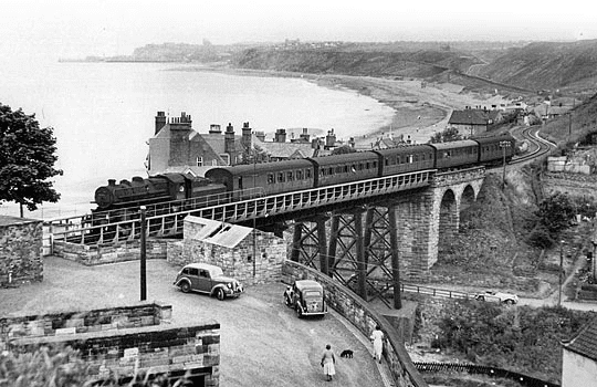
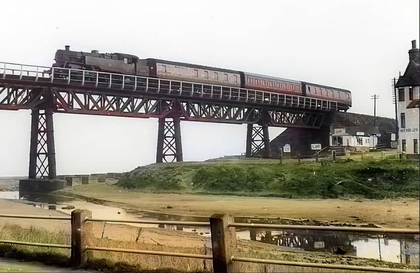
Sandsend Viaduct Lythe Bank > Sandsend Viaduct East Row
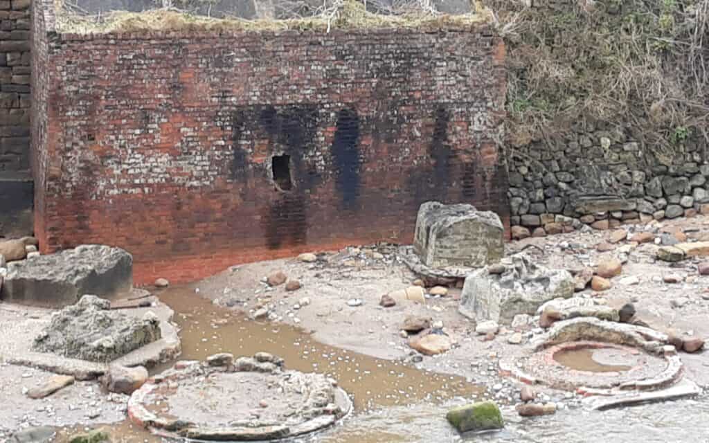
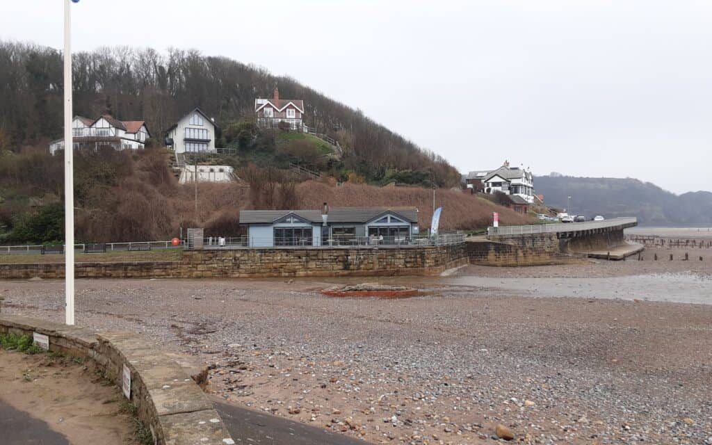
Lythe Bank foundation remains > East Row foundation remains
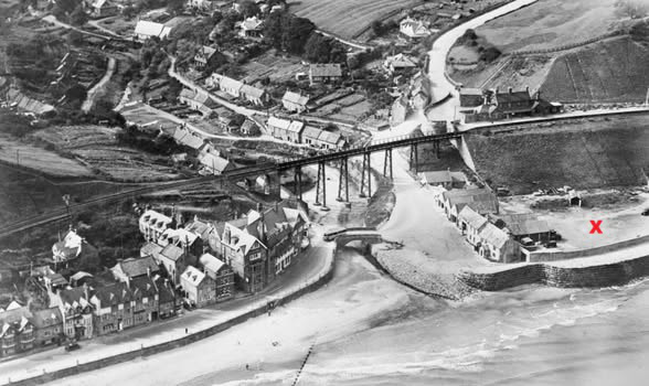
Sandsend Viaduct Lythe Bank, 1929. X = the site of the Alum House, now buried below a car park!
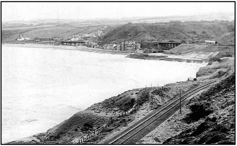
Sweep across Sandsend
>>>>
The gentle climb out of Sandsend is along the footway. The road initially runs adjacent to the old railway line, before veering inland. At Raithwaite a short diversion is possible to get a surprisingly close encounter to what was Newholm Viaduct. The line now cuts through the golf links and on private land, so a return to the footway it is! (there is some interesting evidence on the club’s “overflow” car park, but permission is required to access).
A temporary rest bite from the traffic, comes courtesy of The Cleveland Way as we literally descend to sea level.
Just as the thread appears to be lost, there is suddenly an arrow of green splendour … clearly the old track-bed, somehow lost in time and spared the veracious appetite to house-build. Soon after however our route does get swallowed up in the housing sprawl, necessitating a zig-zag of intrigue to takes us back into the town centre … but not before getting a magnificent close up of West Cliff Station.
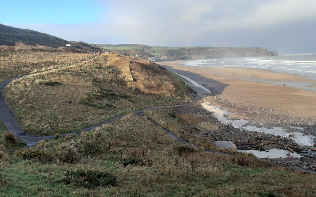
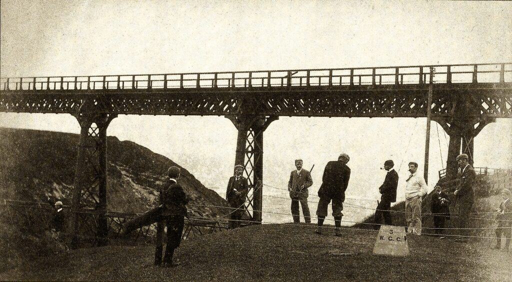
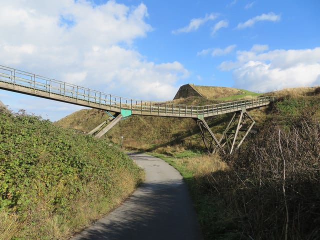
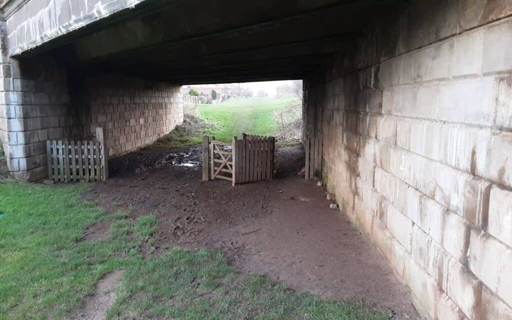
Near Raithwaite > The 3rd tee (now the 18th!) > Golf links now > Under White Bridge Road

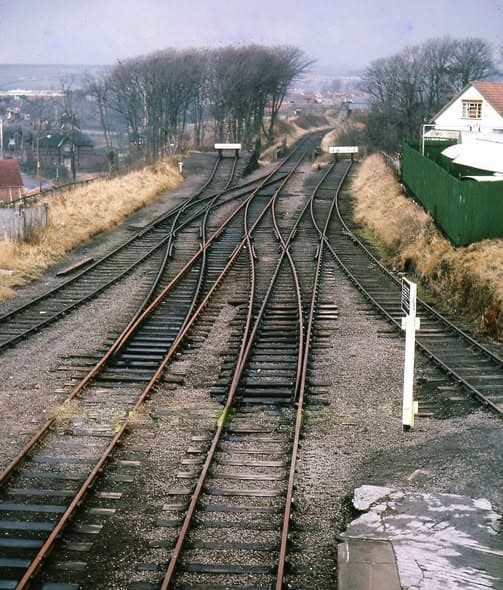
The complex track layout … facing south east of West Cliff Station
>>>>
Our finale takes in the beginning of the ‘Cinder Track’ at Stakesby Vale and heads in the direction of Scarborough. Out line soon diverts off to the right … Prospect Hill Junction .. to swing around in a semi-circle to go under the leviathan of Larpool Bridge and alongside the existing Esk Valley Line. It is possible to trace the course, but DO NOT proceed beyond Larpool Bridge … to avoid trespassing!
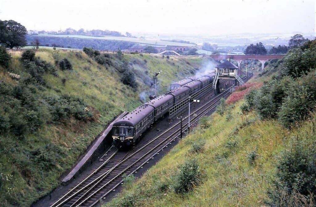
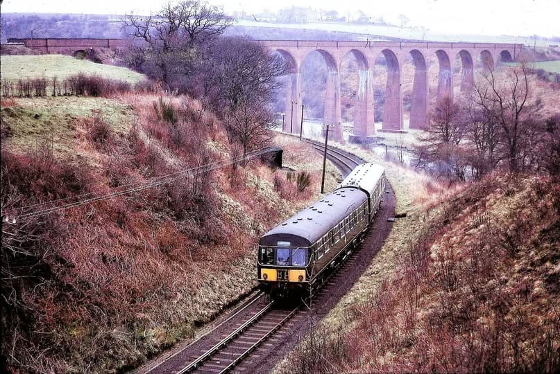
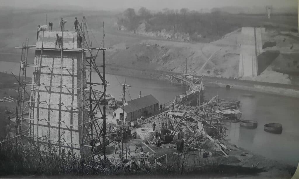
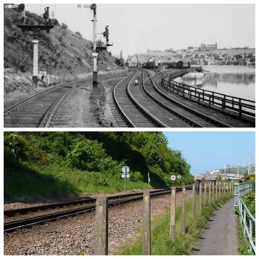
Prospect Hill Junction > Ascending Prospect Hill > Larpool Bridge construction > Bog Hall Junction
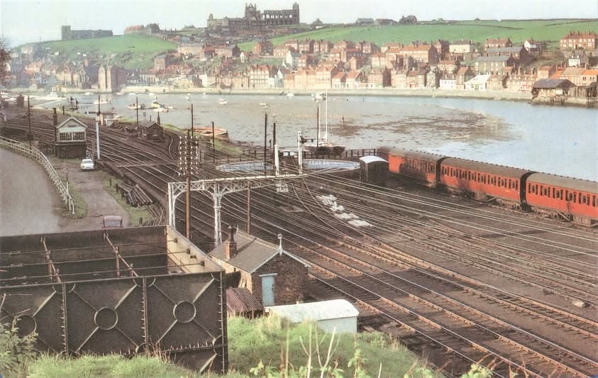
Bog Hall Junction, approaching Whitby town … complete with turntable
>>>>
ACKNOWLEDGEMENT: Dave Kirk
EPISODE III ~ A Tale Of Three Castles ~ exploring the Mulgrave Estate (5.4 miles)
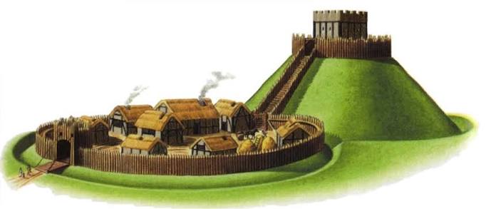
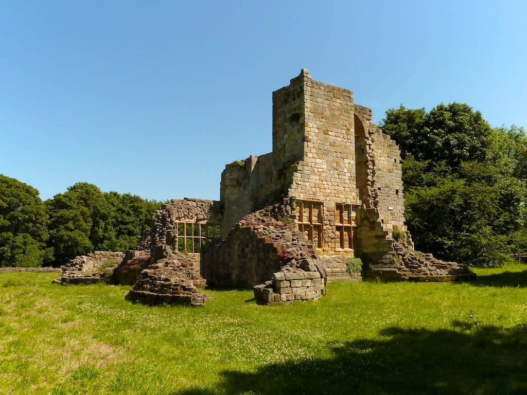
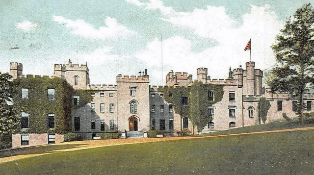
Foss Castle >>>>>>>>>>>>>>>>>>>>>Old Castle>>>>>>>>>>>>>>>>>>>>>>New Castle
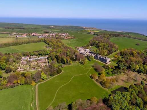
The magnificent Mulgrave Estate (open to the public on Wednesdays, Saturdays and Sundays, but closed throughout May) offers some of the best walking trails in the Whitby area and is home to three castles. Their stories span over 900 years! but are not widely known … let’s go and find out more.
Our walk starts at East Barnby and heads east above Cow Pasture Plantation. Although our route further on goes very close to the new castle, it is deliberately kept out of sight. Unless you are lucky enough to visit one of the marchioness’ garden open days, the stately home is best viewed only from afar … hence the unconventional beginning.
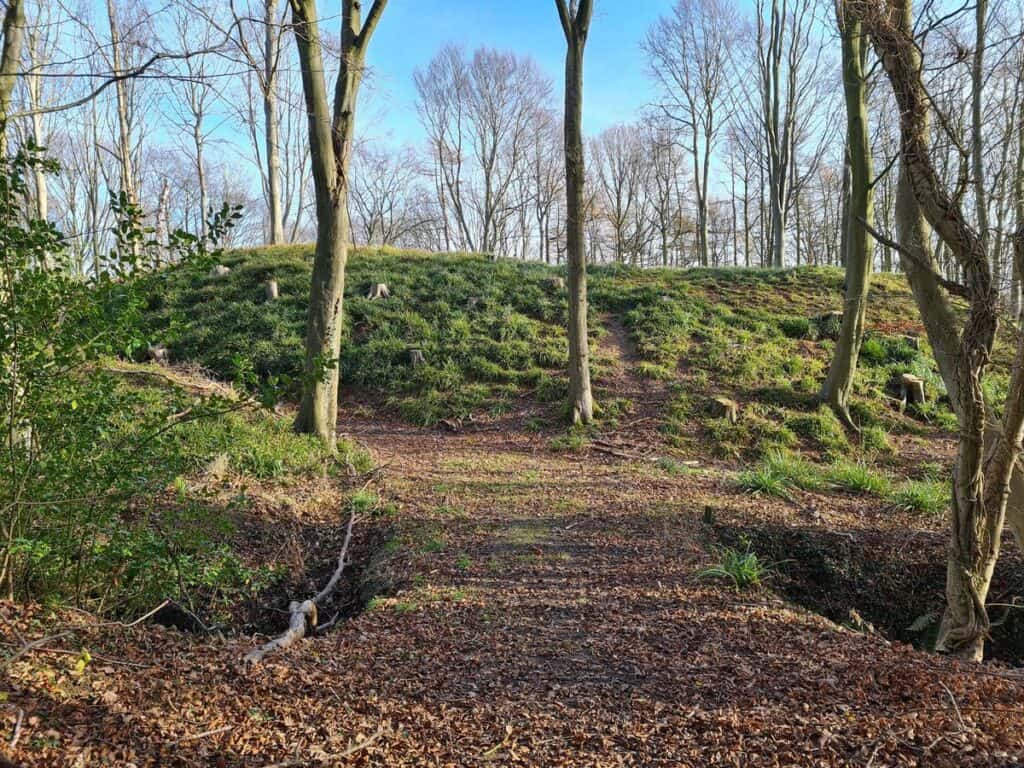
Foss Castle ~ was built in the early 1070s, soon after the Norman Conquest, by Nigel Fossard. He was a major Norman landowner with extensive estates and several castles throughout Yorkshire and beyond. Foss (or Lythe) Castle would have been his administrative centre for this region and was used up to its stone replacement (the Old Castle) in the 14th century.
The earthwork motte and bailey fortress stands against the deep gorge of Mickleby Beck. The large circular flat-topped motte is encased by a wide ditch and crowned by the remains of a rampart. Protected on the south and west by steep slopes, the motte is flanked by a northern triangular bailey and a larger southern rectangular bailey. A north-eastern ditch and the steep scarp of a western stream also gave defence to the open side of the castle.
From the castle, we pass the ruins of Lythe Mill. It was once a three-story, water powered corn mill … complete with a stone inscription .. “1809”. The beck was traditionally crossed via a ford, but the installation of a new (2026) footbridge now affords an all weather and dry foot solution!
A well-defined track takes us nicely to our next castle. This would have been the primary way in to the drawbridge entrance.
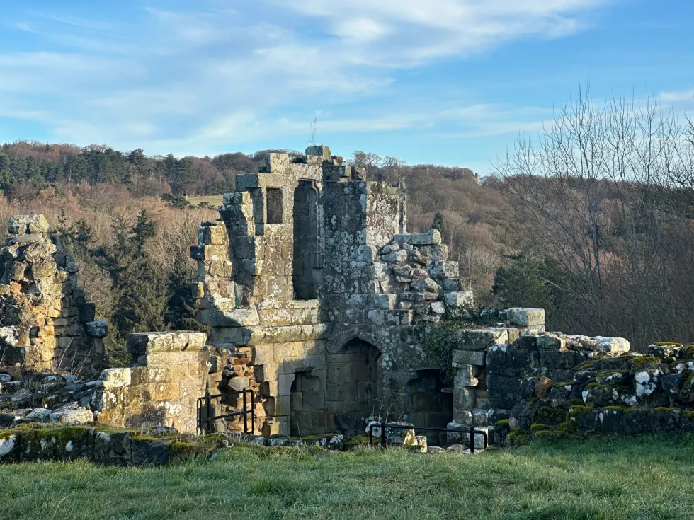
Old Castle ~ was constructed tin the 13th century as a defensive residence, replacing the earlier Foss Castle. Since then, it has been home to the de Mauley family. the Bigot family, the Radcliffe family and Edmund Lord Sheffield, though none undertook the monumental efforts to sufficiently restore this now historic castle ruin.
The castle was built piecemeal on a narrow ridge between the Sandsend and East Row Becks starting in 1069. By the time it was bestowed upon Peter de Mauley (a notoriously cruel henchman of King John, believed to have killed Arthur of Brittany in 1203), there would have been an oval-shaped platform surrounded by a high curtain wall with dry moats that framed either end of the structure as well as a drawbridge and a three-story tower keep.
By 1309, however, the castle was reportedly already in ruins, and deteriorated further still while it changed hands into the 17th century. In 1626, it briefly served as a semi-open-air hunting lodge, though at the outbreak of the English Civil War in 1642, Royalists forces saw tactical potential in the structure and seized it for war purposes. Upon victory, it was destroyed to prevent future use as a military base.
Once a new Mulgrave Castle was built nearby, the Earl of Mulgrave ordered his landscaper to romanticize the ruins of the old castle, rebuilding the gatehouse towers, remodeling sections of the collapsed keep and beautifying the surrounding woodlands. With later restorations in the 1990s, several features were further fortified and landscapes to its present condition.
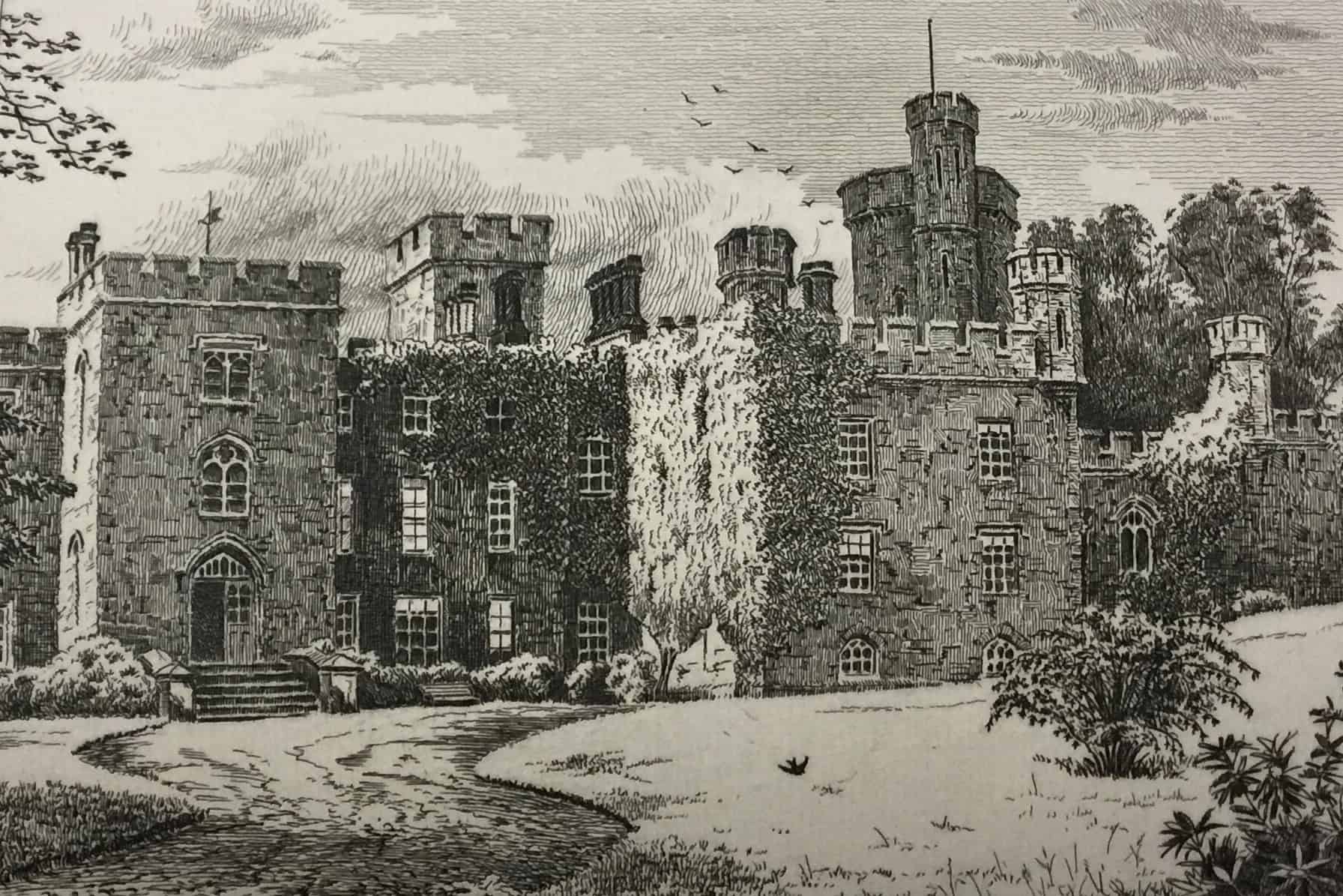
New Castle ~ was
>>>>