Cycle Routes
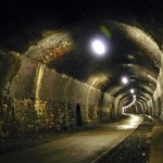
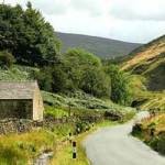
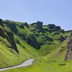
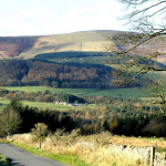
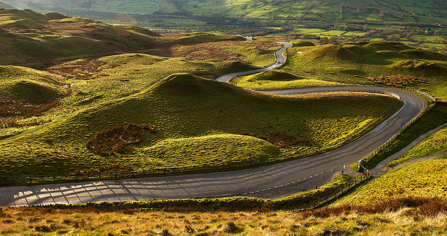 Mam Tor … the descent into Edale Valley
Here’s something that I began in 2015 and have been developing ever since …
I have finally had to concede that “weekends” are a thing of the past,  with a large number of us having to work on Saturday or Sunday. It has been frustratingly difficult to produce group events for a time when everyone is available, this has been the main factor in my deciding to move away from leading in favour of writing. The other (age-old) problem for us leaders is constantly worrying (I assure you it is a worry!) about our fickle weather!
So, rather than missing out, this is my solution. If successful I will extend to include a programme of regional walks (I have already done this for Whitby) …
Here are a series of self-led cycle rides. Although originally designed as practice sessions for those going on our cycling holidays … to replicate distance, climbing and terrain .. they can be enjoyed by anyone. They are all my own work (except the Preston Wheel) … I will gladly provide you with full information and relevant digital mapping (it will cost ya a pint!).
This is not just designed as a great way of keeping fit … it will test your bike and kit, and also hone your map reading skills!
The beauty of doing it this way is that you can ‘cherry pick’ your own date; to suit the weather, conditions and your diary. Some of you have done some of them before, I urge you to try them again … it will give you an invaluable experience at navigating on your own.
I hope you enjoy them(?) … VA
L = Local (ie starts and finishes in Prestwich) / C = Transport (car or van required to get you and your bike to start) / T = Train (from Manchester Victoria)
Estimated times are calculated on distance, ascent & descent and terrain
CH = CYCLE HIRE IS AVAILABLE
 These routes are motorised-scooter friendly, in full or part.
NOTE – This project has generated a lot of interest (particularly with ‘born-again’ cyclists) … surprising me somewhat, as I do not profess to be an expert in the field of cycling. I do reckon though, judging by the enjoyment (and appreciation) people seem to get by following my routes, that I do have something to offer(?). The key to people of an ‘older generation’, who have not ridden for many a year, is CONFIDENCE. With this in mind, I have put the routes in the sequence they should be attempted … taking into account not only statistics but terrain, navigation and friendliness to cyclists (namely traffic!). The other great modern invention is the e-bike … the opportunities for everyone have suddenly become endless.
EASY

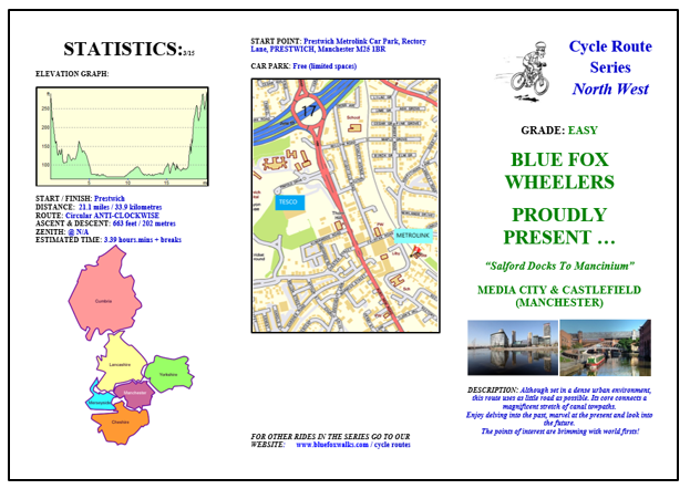
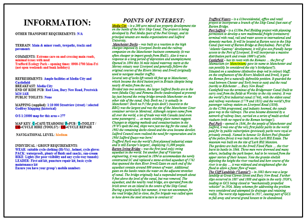
![]() 6 – MEDIA CITY & CASTLEFIELD (Manchester Urban) M2M ~ 21.3 miles / 672 feet ascent / est. 3.46 hours.mins + br. – L
6 – MEDIA CITY & CASTLEFIELD (Manchester Urban) M2M ~ 21.3 miles / 672 feet ascent / est. 3.46 hours.mins + br. – L
![]()
7 – LYNNYSHAW LOOPLINE & SWINTON GREENWAY (Salford Urban) alternative to 6 ~ 19.2 miles / 1167 feet ascent / est. 3.42 hours.mins + br. – L
![]()
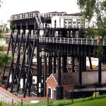
![]() 1 – PRESTON WHEEL (Lancashire) C2C ~ 20.9 miles / 863 feet ascent / est. 3.42 hours.mins + breaks – C CH
1 – PRESTON WHEEL (Lancashire) C2C ~ 20.9 miles / 863 feet ascent / est. 3.42 hours.mins + breaks – C CH
![]() 4 – LANCASTER CITY, MORECAMBE TOWN & HEYSHAM VILLAGE (Lancashire) B2B ~ 21.5 miles / 881 feet ascent / estimated 3.46 hours.mins + breaks – C
4 – LANCASTER CITY, MORECAMBE TOWN & HEYSHAM VILLAGE (Lancashire) B2B ~ 21.5 miles / 881 feet ascent / estimated 3.46 hours.mins + breaks – C
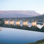
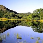
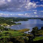
![]() 5 – DERWENT VALLEY (Derbyshire) NoR ~ 22.1 miles / 1999 feet ascent / estimated 4.11 hours.mins + breaks – C CH
5 – DERWENT VALLEY (Derbyshire) NoR ~ 22.1 miles / 1999 feet ascent / estimated 4.11 hours.mins + breaks – C CH
![]() – DERWENT VALLEY ALTERNATIVE (1A) (INTRODUCTION) SHORTER LOOP = 10.5m / 1100’^
– DERWENT VALLEY ALTERNATIVE (1A) (INTRODUCTION) SHORTER LOOP = 10.5m / 1100’^
![]() 2 – CHESTER CIRCULAR (Cheshire) ~ 24.9 miles / 466 feet ascent / 4:15 hours:mins + breaks C
2 – CHESTER CIRCULAR (Cheshire) ~ 24.9 miles / 466 feet ascent / 4:15 hours:mins + breaks C
![]() 3 – SALE WATER PARK & DUNHAM MASSEY (Cheshire) ~ 24.9 miles / 331 feet ascent / est 4.18 hours.mins + breaks – C CH
3 – SALE WATER PARK & DUNHAM MASSEY (Cheshire) ~ 24.9 miles / 331 feet ascent / est 4.18 hours.mins + breaks – C CH
![]()
MODERATE
![]() 4 – BAKEWELL & MONSAL TRAIL (Derbyshire) ~ 25.2 miles / 2901 feet ascent / estimated 4.07 hours.mins + br. – C
4 – BAKEWELL & MONSAL TRAIL (Derbyshire) ~ 25.2 miles / 2901 feet ascent / estimated 4.07 hours.mins + br. – C
![]() 5 – TISSINGTON TRAIL & MANIFOLD TRAIL (Derbys & Staffs) B2B ~ 30.2 miles / 3061 ft ascent / est 4.31 h.m + breaks – C CH
5 – TISSINGTON TRAIL & MANIFOLD TRAIL (Derbys & Staffs) B2B ~ 30.2 miles / 3061 ft ascent / est 4.31 h.m + breaks – C CH
![]() 10 – FOREST OF BOWLAND WEST (Lancashire) M2M ~ 31.6 miles / 3200 feet ascent / estimated time 4.44 hours.mins – C
10 – FOREST OF BOWLAND WEST (Lancashire) M2M ~ 31.6 miles / 3200 feet ascent / estimated time 4.44 hours.mins – C
![]() 11 – PENNINE BRIDLEWAY & CARSINGTON WATER (Derbyshire) ~ 32.6 miles / 3065 feet ascent / estimated 4.47 hours.mins – C
11 – PENNINE BRIDLEWAY & CARSINGTON WATER (Derbyshire) ~ 32.6 miles / 3065 feet ascent / estimated 4.47 hours.mins – C
![]() 2 – DELAMERE FOREST (Cheshire) NoR ~ 32.1 miles / 1550 feet ascent / estimated 4.51 hours.mins + breaks – C
2 – DELAMERE FOREST (Cheshire) NoR ~ 32.1 miles / 1550 feet ascent / estimated 4.51 hours.mins + breaks – C
![]()
6 – BELMONT & JUMBLES (Lancashire) C2C ~ 33..5 miles / 2579 feet ascent / estimated 4.51 hours.mins + breaks – L
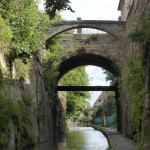
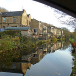
![]() 1 – HUDDERSFIELD NARROW CANAL (Yorkshire & Grt M/cr) C2C ~ 29.3 miles / 1914 ft ascent / est 5.09 h.m + breaks – T
1 – HUDDERSFIELD NARROW CANAL (Yorkshire & Grt M/cr) C2C ~ 29.3 miles / 1914 ft ascent / est 5.09 h.m + breaks – T
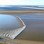
![]() 7 – MORECAMBE BAY & LUNE VALLEY (Lancashire) M2M ~ 33.8 miles / 2381 ft ascent / est 5.15 hours.mins + breaks – C
7 – MORECAMBE BAY & LUNE VALLEY (Lancashire) M2M ~ 33.8 miles / 2381 ft ascent / est 5.15 hours.mins + breaks – C
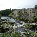
![]() 8 – CRAVEN ROUND (Yorkshire) ~ 25.7 miles / 1725 feet ascent / estimated 5.26 hours:mins + breaks – C
8 – CRAVEN ROUND (Yorkshire) ~ 25.7 miles / 1725 feet ascent / estimated 5.26 hours:mins + breaks – C
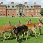
![]() 3 – HAIGH HALL & ANGLEZARKE (Lancashire) B2B ~ 25.7 miles / 1725 ft ascent / estimated 5.26 hours.mins + breaks – C
3 – HAIGH HALL & ANGLEZARKE (Lancashire) B2B ~ 25.7 miles / 1725 ft ascent / estimated 5.26 hours.mins + breaks – C
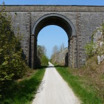
![]() 9 – ROCHDALE CANAL (Yorks & Grt M/cr) NoR ~ 34.3 miles / 1337 feet ascent / estimated 6.05 hours.mins + br. – T
9 – ROCHDALE CANAL (Yorks & Grt M/cr) NoR ~ 34.3 miles / 1337 feet ascent / estimated 6.05 hours.mins + br. – T
NEW DALBY FOREST & VALE OF PICKERING (Yorkshire) ~ awaiting reccee
![]()
STRENUOUS
![]() 1 – PEAK DISTRICT LOOP (Derbyshire) M2M ~ 32.5 miles / 4700 feet ascent / estimated 5.23 hours.mins + breaks – C
1 – PEAK DISTRICT LOOP (Derbyshire) M2M ~ 32.5 miles / 4700 feet ascent / estimated 5.23 hours.mins + breaks – C
2 – SOUTH PENNINES & HEBDEN BRIDGE (Yorks / Grt M/cr) B2B ~ 37 miles / 3600 feet ascent / est 5.53 hours.mins + br. – T
3 – FOREST OF BOWLAND NORTH (Lancashire) C2C ~ 39.5 miles / 5000 feet ascent / estimated 6.07 hours.mins + breaks – C
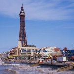
![]() 4 – BLACKPOOL TO PRESTWICH (Lancashire) NoR ~ 53.5 miles / 3500 feet ascent /estimated 9.07 hours.mins + breaks – T
4 – BLACKPOOL TO PRESTWICH (Lancashire) NoR ~ 53.5 miles / 3500 feet ascent /estimated 9.07 hours.mins + breaks – T
NEW NORTH YORK MOORS ROUND (Yorkshire) ~ awaiting reccee
![]()
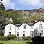
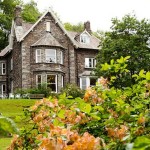
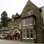
HOSTEL STAYOVERS (LAKE DISTRICT)
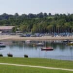
![]() 1 – Coniston Lake Round (Coniston YHA) ~ 15.35 miles / 1366 feet ascent / est 2.38 hours.mins + br. – C
1 – Coniston Lake Round (Coniston YHA) ~ 15.35 miles / 1366 feet ascent / est 2.38 hours.mins + br. – C
![]() 2 – Thirlmere Lake, Rydal Water & Grasmere Lake Rd (Grasmere YHA) NoR ~ 26.77 m / 3002 ft a / est. 4.04 h.m + br. – C
2 – Thirlmere Lake, Rydal Water & Grasmere Lake Rd (Grasmere YHA) NoR ~ 26.77 m / 3002 ft a / est. 4.04 h.m + br. – C
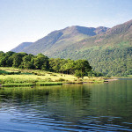
![]() 5 – Loweswater, Crummock Water & Buttermere (Buttermere YHA) ~ 17.35 m / 1675 ft ascent / est. 4.06 h.m + br. – C
5 – Loweswater, Crummock Water & Buttermere (Buttermere YHA) ~ 17.35 m / 1675 ft ascent / est. 4.06 h.m + br. – C
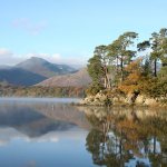
![]() 4 – Derwent & Bassenthwaite Lakes Round (Keswick YHA) B2B ~ 27.55 m / 2789 ft ascent / est 4.21 h.m + br. – C
4 – Derwent & Bassenthwaite Lakes Round (Keswick YHA) B2B ~ 27.55 m / 2789 ft ascent / est 4.21 h.m + br. – C
![]() 6 – Ullswater Lake Round (Patterdale YHA) M2M ~ 23.52 miles / 2710 feet ascent / estimated 4.47 hours.mins + breaks – C
6 – Ullswater Lake Round (Patterdale YHA) M2M ~ 23.52 miles / 2710 feet ascent / estimated 4.47 hours.mins + breaks – C
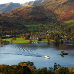
![]() 3 – Windermere Lake Round (Hawkshead YHA) C2C ~ 34.48 miles / 2851 feet ascent / estimated 5.33 hours.mins + br. – C
3 – Windermere Lake Round (Hawkshead YHA) C2C ~ 34.48 miles / 2851 feet ascent / estimated 5.33 hours.mins + br. – C
TIME CALCULATION: Although subjective, I have based the timings on: terrain, ascent & descent, traffic (eg. in an urban environment) and enjoyment factor! … I will leave length and frequency of breaks/stops to you(?).
… and ‘still on the drawing board’ ..
DALBY FOREST & VALE OF PICKERING (Yorkshire) Moderate
FOOT OF PENDLE HILL CIRCULAR (Lancashire) Strenuous
HAMBLETON ROUND (Yorkshire) Moderate or Strenuous(?)
HARROGATE ROUND (Yorkshire) Moderate or Strenuous(?)
LIVERPOOL LOOPLINE (Merseyside) Easy or Moderate(?)
MATLOCK BATH & RIVER DERWENT (Derbys.) Moderate or Strenuous(?)
RICHMONDSHIRE ROUND (Yorkshire) Moderate or Strenuous(?)
RYEDALE ROUND (Yorkshire) Moderate or Strenuous(?)
SELBY ROUND (Yorkshire) Moderate or Strenuous(?)
YORK ROUND (Yorkshire) Easy
and here’s a long distance one to consider …
TRANS-PENNINE TRAIL ~ Hornsea to Southport ~ 215 miles of mainly traffic-free, well-surfaced and level trails(???)
Foxxy Tip …
![]()
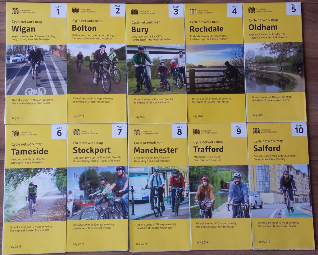
Transport for Greater Manchester have produced an incredible range of detailed cycle network maps … one each for the ten boroughs that make up the metropolitan county. They are available FREE to download or obtain in paper format from your local ‘Travelshop’.
www.tfgm.com/cycling
Foxxy Tip …
Along with the e-bike, the other great technological advance in recent years has been the advent of navigational aids. In days gone by, we relied on reading paper maps whilst simultaneously riding … a real (perilous) art!
You will all have your own preferences and probably know more on the subject than me, but I do want to mention what I use and what a complete gamechanger it is:
Using a dedicated smartphone, I can transfer my digitally produced (Memory Map in my case) cycle route from my pc to this smartphone.
The phone is affixed to a cycle mount on my handlebars … this fully rotates to afford map orientation.
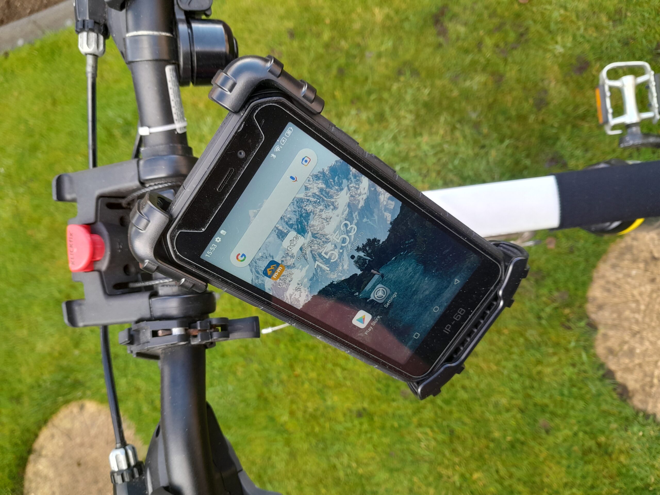
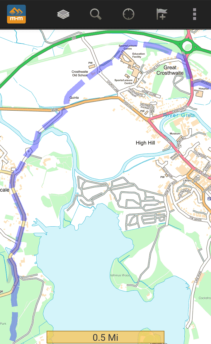
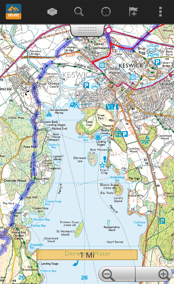
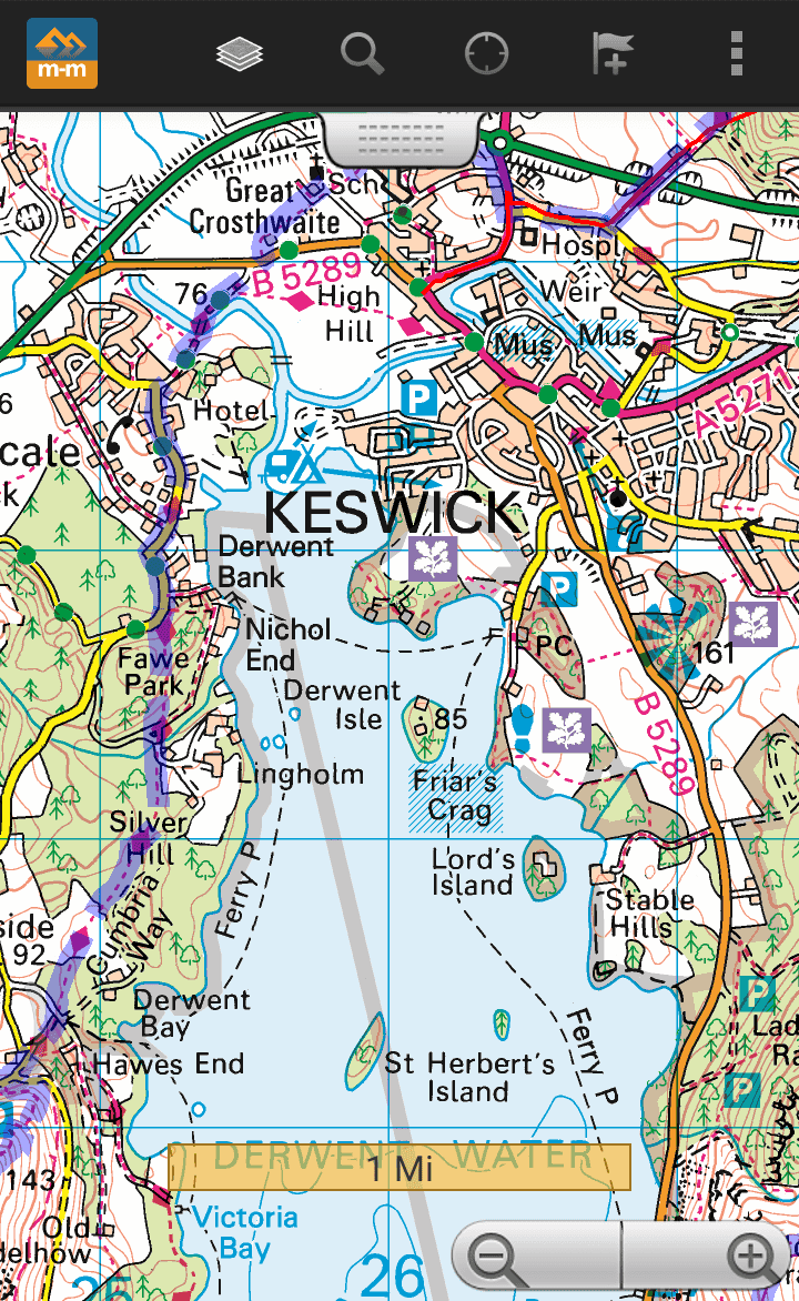
I can easily interchange map scales … from 1:10,000 > 1:25,000 > 1:50,000