Pennine Way
I have walked many long-distance trails in Britain throughout my lifetime but, for some unknown reason, I have never previously fancied doing this one. The 50th anniversary in 2015 reinvigorated a lot of interest in the Pennine Way … it’s about time that I embark on the challenge (whilst I still can!).
Unlike most of my other ‘projects’, I am not writing about my forthcoming adventure to offer comprehensive advice to anyone who is considering a similar attempt … there are plenty of sites that cover just about every planning and information aspect that is required. Also, I will not be staying precisely faithful to the ‘official’ route, but deviating off to throw in some points of interest of my own or as accommodation needs dictate … I do know that I am relishing tackling England’s “toughest long-distance trail”!
www.penninewayassociation.co.uk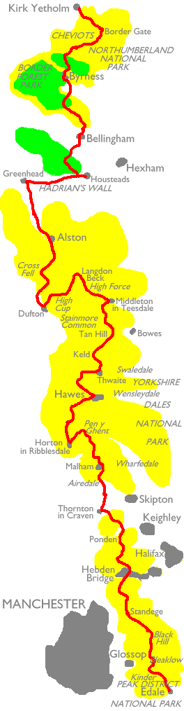
The Pennine Way is Britain’s oldest National Trail. Running for 268 miles along the spine of England (and beyond!) few could argue with its pedigree, attracting walkers (some 1800 complete the full length each year!) from all over the world. It is a unique demonstration of how our nation’s landscape changes so dramatically over a relatively small area … from the grit-edged Peak District, through the rolling drystone-walled Yorkshire Dales, to the heather-clad hills of Northumberland. It crosses six counties and three national parks. For its origins, we need to look no further than the figure of Tom Stephenson … a Fleet Street journalist, intellectual, conscientious objector and eventual long-term secretary of the Ramblers’ Association. He was first inspired on his quest to found a grand English way by a letter written to the ‘Daily Herald’ newspaper in 1935. In it, two American girls asked for some walking advice … wondering if there was anything in England to match their own Appalachian Trail(?).
It took thirty years to get from the drawing board to the official opening ceremony (actually in Malham) … for it must be remembered that it was a time when much of our uplands were the preserve of grouse-shooters and out of bounds to general members of the public (Kinder Trespass!!!). It was an amazing show of persistence on the part of Tom to painstakingly win round the politicians. Although there were many others who fought their own battles along the way, we owe so much to his tenacity.
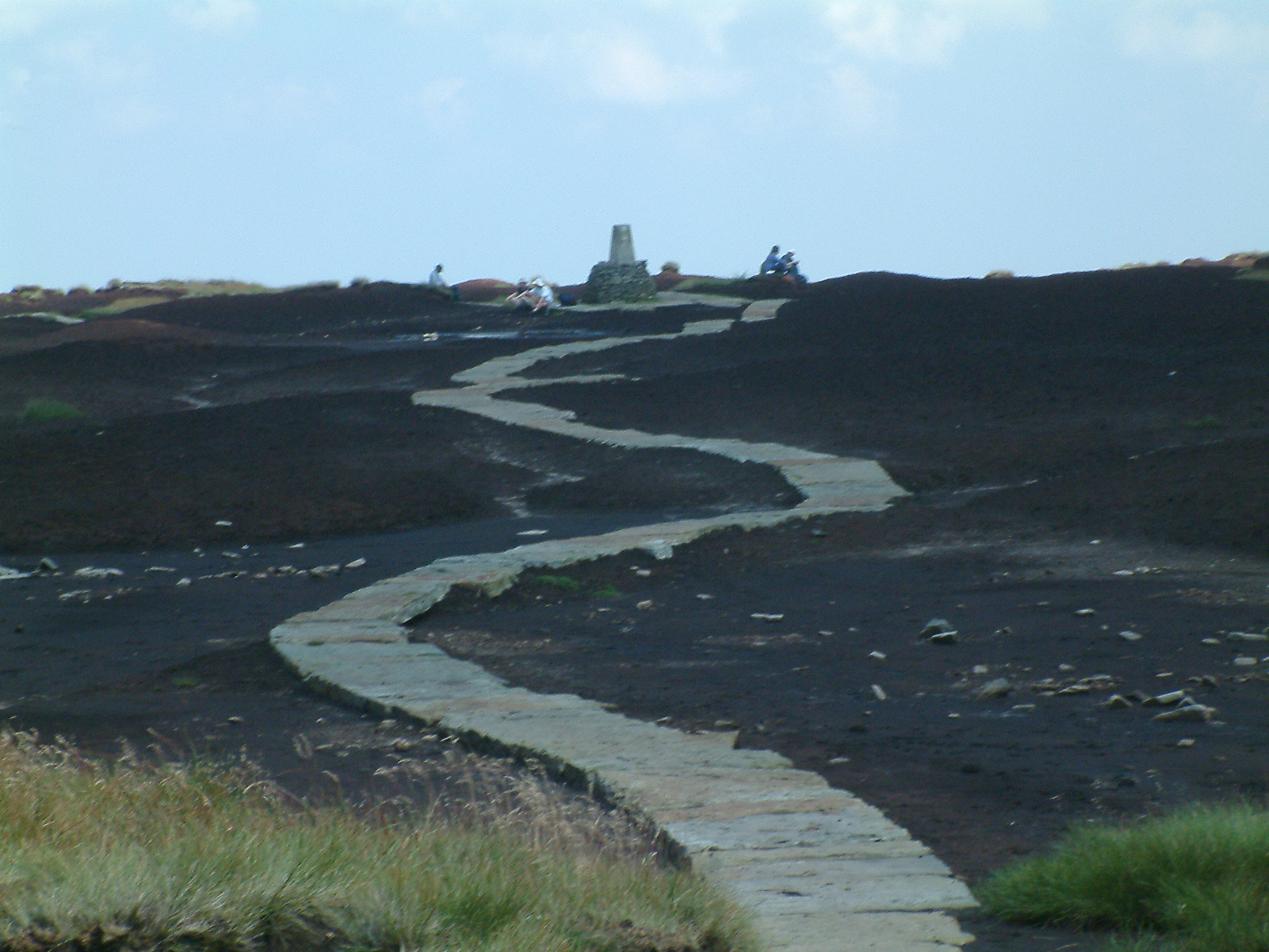
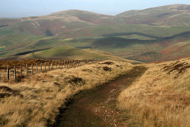
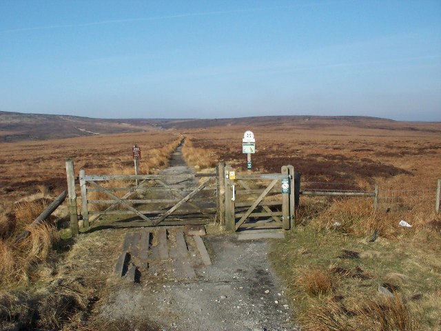
Credit must be paid to the army of people who have worked so hard to improve much of the boggiest sections of the trail by laying down flagstones and wooden palings … arguably an eyesore(?), but vital to preserve the paths and encourage future generations of Pennine-Wayers!!!
Chapter I 2015 ~ Edale to Horton in Ribblesdale

~
Chapter II tba ~ Horton in Ribblesdale to Dufton

~
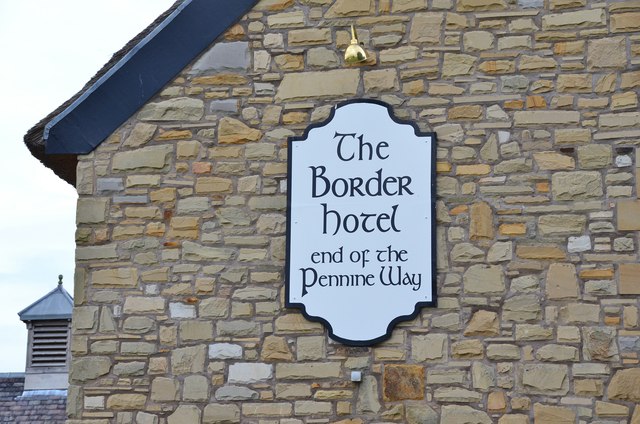
Chapter III tba ~ Dufton to Kirk Yetholm
~
The Pennine Way … My Way!
Chapter I (October 2015)
Day One: Edale > Hadfield = 16.8 miles / 2374 feet ascent / 2580 feet descent
A magnificent, but tough, ‘opener’ … this connects the two legendary giants of Kinder and Bleaklow. My own start does not follow the official route, preferring instead to take the best way up onto the ‘tops’ … via Grindsbrook Clough.
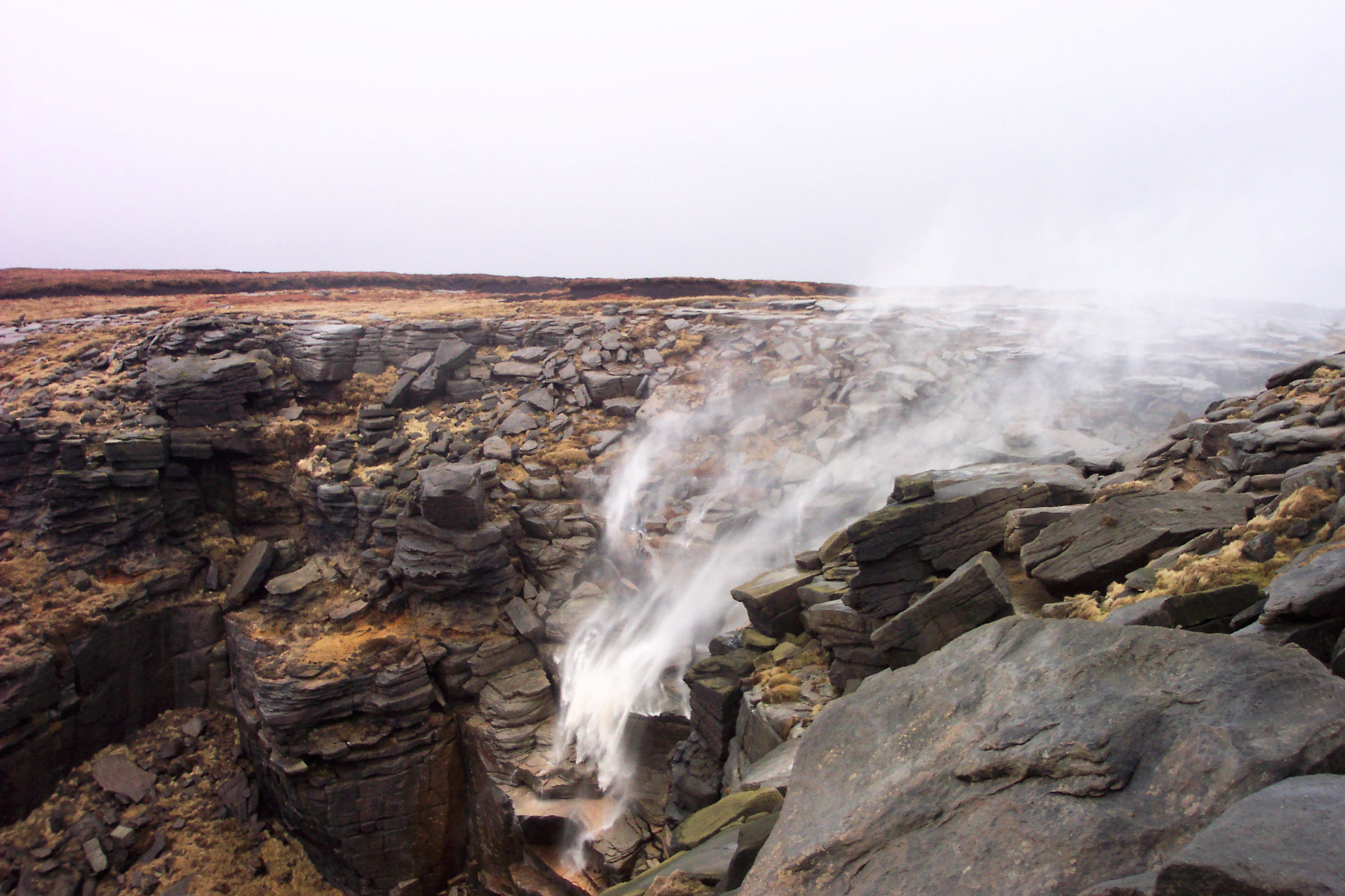
Across the featureless, but spectacular, plateau to Kinder Gates … by tracing the faint “old” Pennine Way and onto the popular landmark of Kinder Downfall.
At Mill Hill, there is an exposed and monotonous, but well-paved, slog to the Snake Pass crossing.
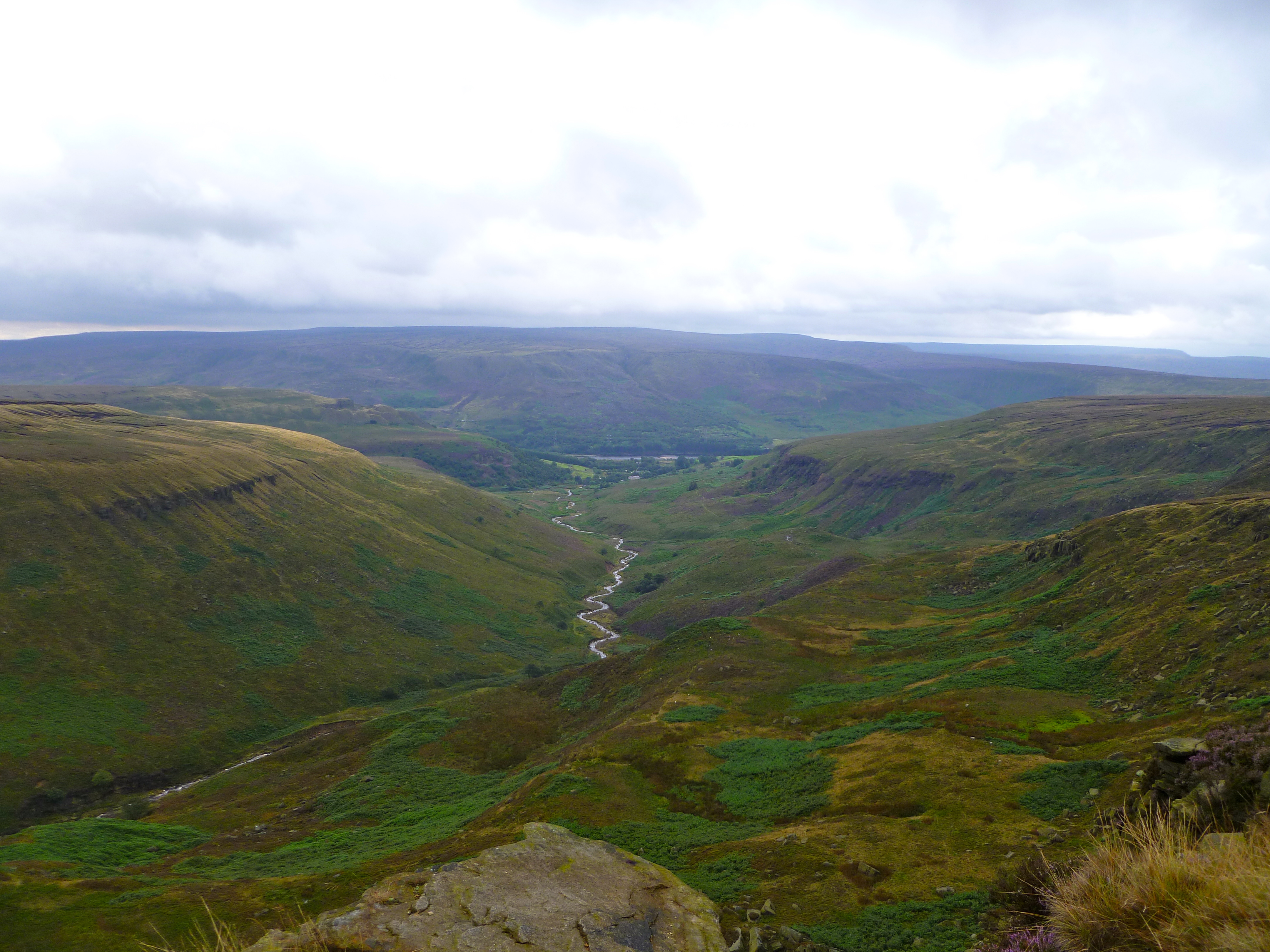
The twisting route over Bleaklow should not be under-estimated! … it is well defined to start with but could prove challenging in poor visibility. The outcome is a breathtaking descent at Wildboar Grains and Clough Edge.


Day Two: Hadfield > Marsden = 16.4 miles / 2949 feet ascent / 2871 feet descent
An extremely easy start, up the Longendale Valley to reach Crowden. As altitude increases up the Crowden Valley so do the breathtaking views!
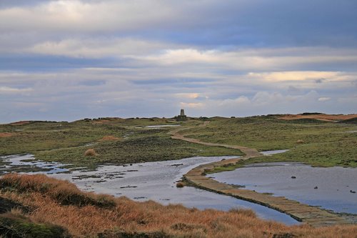
The moors around Black Hill are exposed and stark, but the PW winds its way through on a convenient ribbon of paving slabs!
More lush beauty comes next, by way of the Wessenden and Blakeley Valleys, before another moorland treat at Black Moss.

Day Three: Marsden > Mankinholes = 14.6 miles / 1940 feet ascent / 1842 feet descent
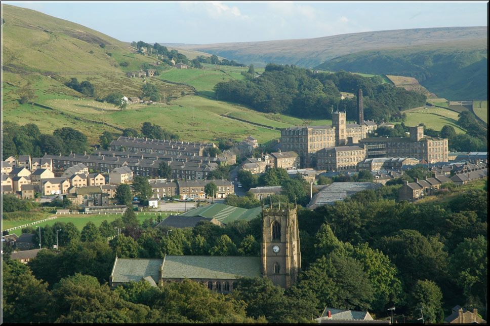
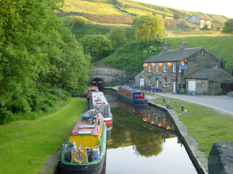
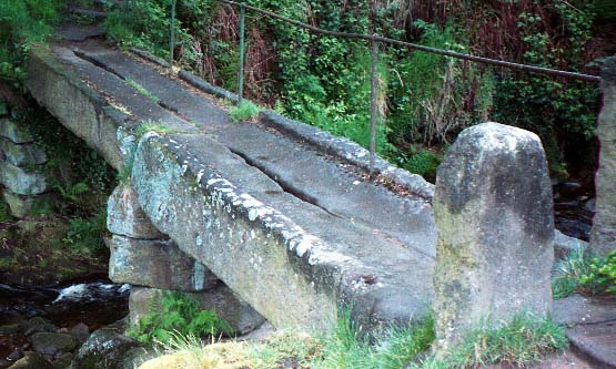
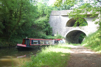
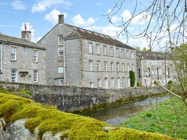
Marsden is a remarkable place with a fascinating past! … along the Huddersfield Narrow Canal to the outstanding Standedge Tunnel. A return to Marsden Moor via Willykay Clough.
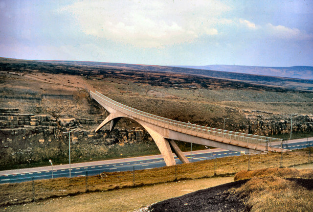
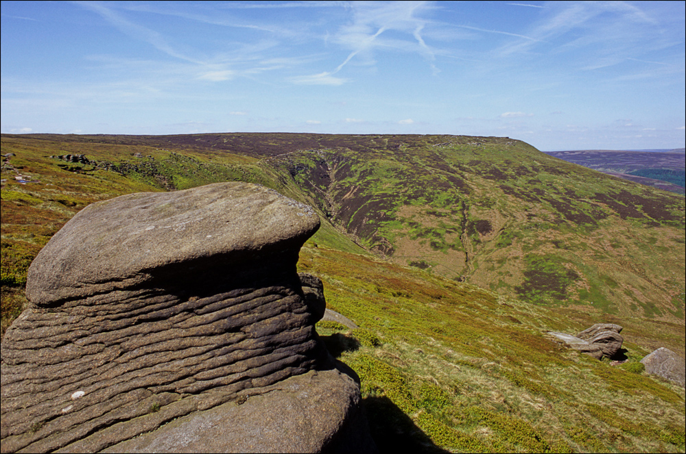
The bleak and barren landscapes of Saddleworth and Rishworth Moors are separated by the landmark bridge crossing of the M62 motorway and interrupted by the haunting outcrop of Blackstone Edge.
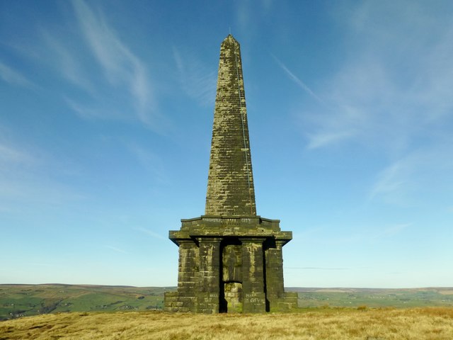
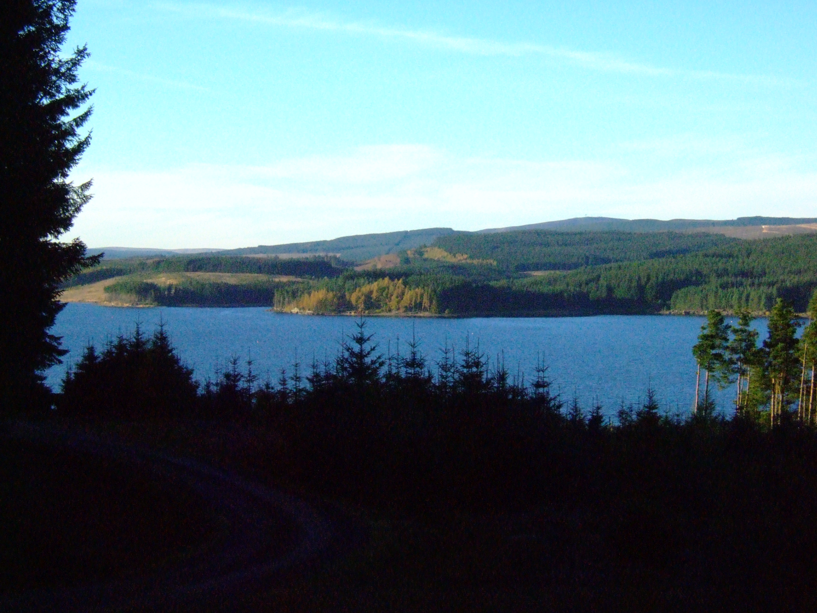
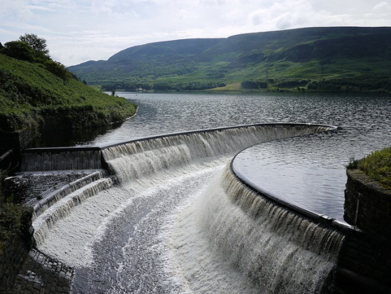
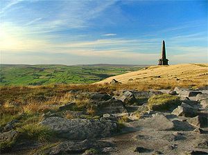
A string of brooding reservoirs edges Stoodley Pike monument closer in the most painstaking manner!

Day Four: Mankinholes > Cowling = 18.8 miles / 3247 feet ascent / 3275 feet descent
A deceptively easy start … following the Rochdale Canal through the CalderValley towards Hebden Bridge. A stiff climb now ensues, plus the tricky undulation of Colden Water, before reaching the iconic outpost of High Gate Farm (aka. May’s Aladdin’s Cave).
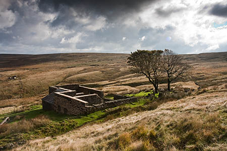
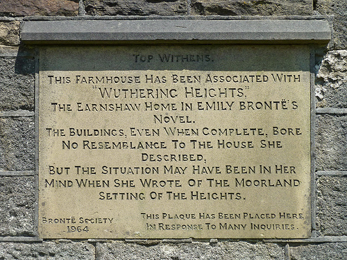
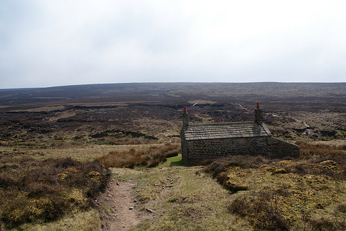
A lengthy moorland stretch connecting the reservoirs of Gorple and Walshaw, before reaching the lush and beautiful world of the Bronte Sisters … complete with the ruins associated with “Wuthering Heights”.
The final leg crosses the peat wilderness of Ikornshaw Moor … a game hunter’s paradise.
Day Five: Cowling > Malham = 17.8 miles / 2459 feet ascent / 2475 feet descent
This opens with two climbs … firstly over to the sleepy village of Lothersdale, then a second (and bigger) ascent up and onto Pinhaw. There are commanding views to the north and east over the Dales and to the west over Pendle Hill & Forest of Bowland.
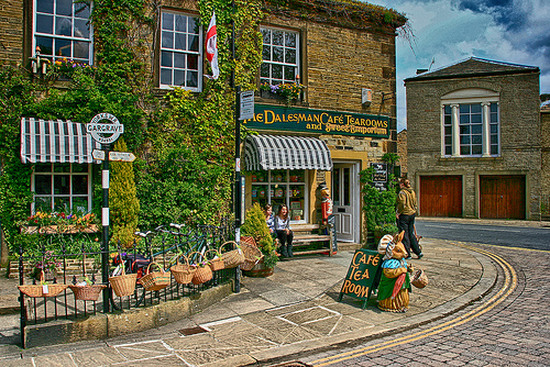
Downhill all the way hereon! … onto picturesque Thornton-in-Craven and a delightful and beautiful low-level stretch to the highly recommended break stop at Gargrave.
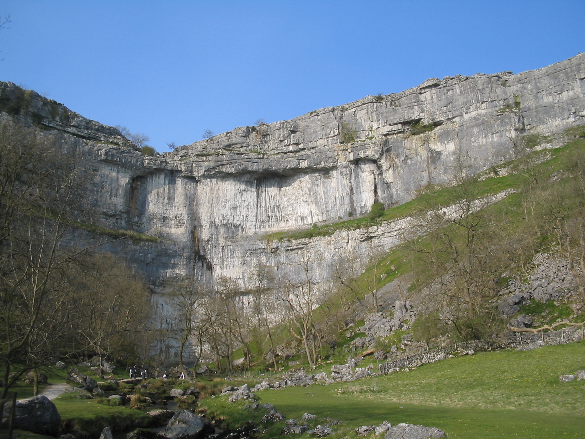
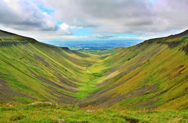
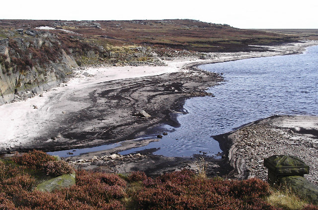
The final third is over gentle limestone-wall clad fields (quintessential Dales), the magnificent sights of Malham Cove and Gordale Scar wonderfully creep ever closer.

Day Six: Malham > Horton in Ribblesdale
TBC
Hints & Tips …
As I have already stated, there are many more people than myself with greater expertise and knowledge on the subject of the PW. However, now that I have embarked in earnest on my own journey, I do feel that I can offer some general words of wisdom(?)! …
- Keep your daily distance to within your own comfort zone (eg. mine is 15-18 miles)
- Remember, 15 miles in glorious sunshine is NOT the same as 15 miles in driving rain! Be prepared for all weathers … because that is exactly what you are likely to encounter!
- Ensure ALL your kit is up to the job.
- Although you will have probably planned your itinerary (and accommodation) well in advance, do NOT be afraid of having a rest day if required. Missing one day, to recuperate from fatigue or minor injury, is far better than having to cancel your adventure altogether in the long run (you can do any missing links another time). Local buses/trains or even taxis can transport you(?). ALSO, many people use a “Sherpa Service”, whereby main luggage is forwarded to the next destination … why not consider hitching a ride with them, they are going to EXACTLY the same place that you want to be!
- As I live in Manchester, it was very easy (in the early stages) for me to commute by train to and from my start points … eliminating the need for accommodation and enabling me to replenish any kit at home.
- The PW is, by and large, simple to navigate … it is very well signed and the paths are obvious and well used. The most daunting sections, over the moors, have been laid with erosion-busting slabs and therefore are reassuringly (in the mist!) easy to follow. You will need to refer to the map to judge your progress and locate your accommodation. A map case alone will not keep your map dry on the most relentless of rainy days, it is also awkward to constantly turn over the page in wind and rain. I use A4 sized (folded and in small plastic bags) disposable digital mapping … my particular route is on it and pertinent details are marked (halfway points, accommodation, facilities, points of interest etc).